Drones, once relegated to the realm of military surveillance, have rapidly evolved into versatile tools with applications in various industries. One of the intriguing questions that arise is whether a drone can effectively take measurements. In this article, we’ll delve into the capabilities and limitations of drones in this regard, exploring their potential across industries and the technology that enables them to perform such tasks.
Drones have revolutionized various industries by providing a bird’s-eye view of situations that were once difficult to access. Their small size, agility, and high-resolution cameras have made them indispensable tools for aerial photography and disaster relief tasks.
How Do Drones Take Measurements?
Modern drones are equipped with various sensors, including GPS, LiDAR, and RGB cameras, that enable them to capture precise data. These sensors work collaboratively to determine position, distance, and elevation, allowing drones to create accurate 3D models of their surroundings.
Applications in Surveying and Mapping
Surveying and mapping, essential in fields like construction and urban planning, have greatly benefited from drone technology. Drones can cover large areas efficiently and generate detailed topographical maps with centimetre-level accuracy.
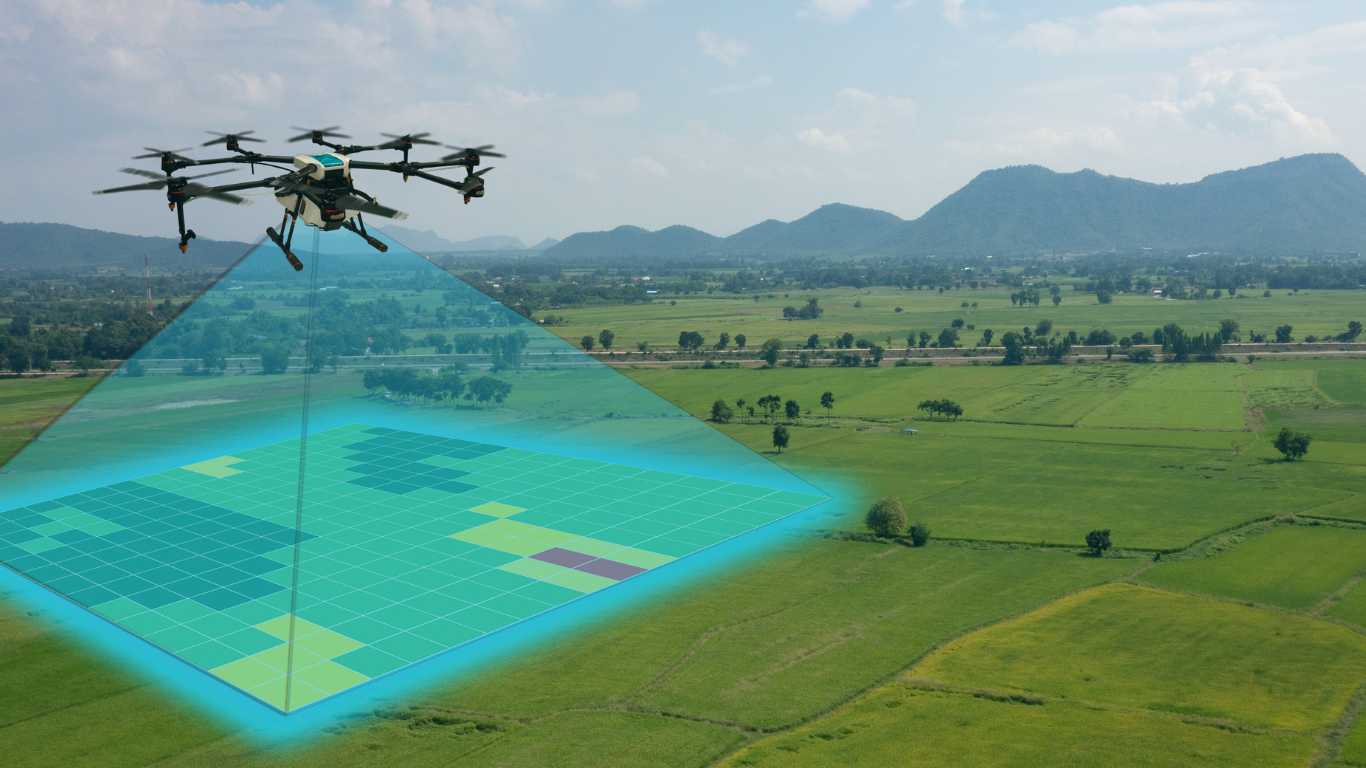
Agricultural Insights: Crop Monitoring and Management
Drones have transformed agriculture by facilitating crop health assessment, irrigation management, and even planting. Thermal cameras on drones can identify variations in soil temperature, enabling farmers to optimize planting patterns.
Infrastructure Inspection from a New Perspective
Traditional infrastructure inspection methods often involve risky human intervention. Drones eliminate this danger by conducting close-up inspections of structures like bridges and power lines, identifying maintenance needs promptly.
Environmental Monitoring and Conservation Efforts
Researchers employ drones to monitor ecosystems, track wildlife, and assess environmental changes. These unmanned aerial vehicles provide a less intrusive way to study sensitive habitats.
Challenges Faced by Measurement-Taking Drones
Operating in diverse environments presents challenges such as adverse weather conditions, complex terrains, and limited battery life. These factors can affect the accuracy of measurements.
Overcoming Limitations with Advanced Technology
Innovations like obstacle detection systems, extended battery life, and improved stabilization mechanisms enhance drones’ measurement-taking capabilities. These advancements are making drones more reliable and versatile.
Ensuring Data Accuracy and Reliability
Data accuracy is crucial, especially in sectors like construction and surveying. Drones need to be calibrated regularly, and data processing techniques must be employed to ensure reliable measurements.
The Human Element: Drone Pilots and Data Analysts
While drones can automate many tasks, skilled drone pilots are essential for safe and effective operations. Data analysts interpret the collected information, translating it into actionable insights.
Regulatory and Ethical Considerations
Concerns about privacy, safety, and compliance with airspace restrictions have been brought to light as a result of the proliferation of drones. Finding a middle ground between prudent drone use and technological advancement should continue to be a top goal.
Future Prospects: What Lies Ahead for Measurement Drones
As technology continues to advance, we can anticipate even more sophisticated measurement capabilities in drones. From construction monitoring to disaster response, drones are set to play a more significant role.
Conclusion
Drones have undoubtedly transformed the way we gather measurements and data across various industries. Their ability to access hard-to-reach places, capture high-quality data, and improve efficiency makes them invaluable tools for modern society.
FAQs:
Can drones replace human surveyors?
While drones can streamline surveying processes, human expertise is still essential for interpreting and analyzing complex data.
Are there limitations to drone flight range?
Yes, drones are limited by battery life and regulatory restrictions on how far they can fly.
How accurate are measurements taken by drones?
With the right sensors and calibration, drone measurements can be highly accurate, often within a few centimeters.
What industries benefit the most from measurement-taking drones?
Construction, agriculture, environmental monitoring, and infrastructure inspection are among the industries that gain significant advantages from drone measurements.
How are privacy concerns addressed when drones take measurements?
Privacy guidelines and geofencing technology are used to ensure that drones do not infringe upon private spaces during measurements.